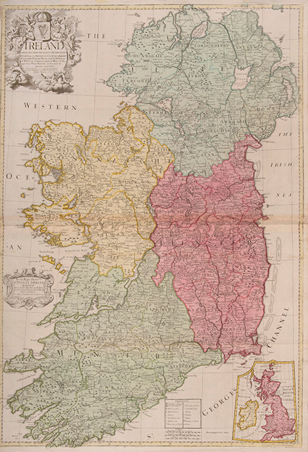

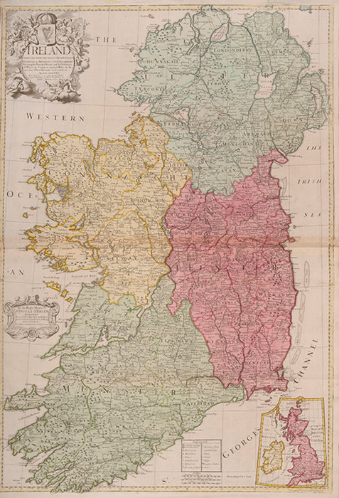
Ireland
Corrected from the Latest Observations Divided into its Provinces, Counties and Baronies. Shewing the Principal Roads, and the Distances of Places, in Common reputed Miles. by Inspection Where Barracks are Erected &c. By John Senex F.R.S.
Stock Code 108447
John Senex F.R.S., the Globe against St Dunstans Church, Fleetstreet, London 1712 [-1728].
Original price
£1,750.00
-
Original price
£1,750.00
Original price
£0.00
£1,750.00
£1,750.00
-
£1,750.00
Current price
£1,750.00
Ireland. John Senex (1678-1740) was one of the foremost mapmakers in England in the early eighteenth century. He was also a surveyor, globemaker, and geographer. As a young man, he was apprenticed to Robert Clavell, a bookseller. He worked with several mapmakers over the course of his career, including Jeremiah Seller and Charles Price. In 1728, Senex was elected as a Fellow of the Royal Society, a rarity for mapmakers. The Fellowship reflects his career-long association as engraver to the Society and publisher of maps by Edmund Halley, among other luminaries. He is best known for his English Atlas (1714), which remained in print until the 1760s. After his death in 1740 his widow, Mary, carried on the business until 1755. Thereafter, his stock was acquired by William Herbert and Robert Sayer (maps) and James Ferguson (globes).
Double-page engraved map on 2 sheets joined, with full contemporary hand-colouring. Inset map of the British Isles, decorative title cartouche surmounted by a harp with a crown above, key table and scale bars. Left margin trimmed to neat line, some light creasing at edges with a couple of tiny marginal tears, otherwise good. Size: 665 mm by 960 mm, sheet size: 680 by 990 mm.
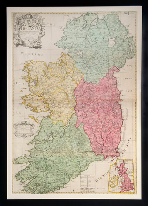
Framed and glazed, overall size: 107cm by 77.3cm by 2cm.
Double-page engraved map on 2 sheets joined, with full contemporary hand-colouring. Inset map of the British Isles, decorative title cartouche surmounted by a harp with a crown above, key table and scale bars. Left margin trimmed to neat line, some light creasing at edges with a couple of tiny marginal tears, otherwise good. Size: 665 mm by 960 mm, sheet size: 680 by 990 mm.
Framed and glazed, overall size: 107cm by 77.3cm by 2cm.
Provenance
Delivery
We offer secure and express delivery on all local and international orders of rare books, maps and prints placed through this website.