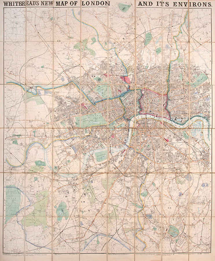

Whitbread's Map of London and its Environs.
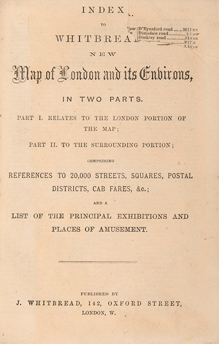
[with] Index... comprising references to 20,000 streets, squares, postal districts, cab fares, &c.; and a list of the principal exhibitions and place of amusement.
Stock Code 110447
London, J. Whitebread, 1874
Original price
£2,250.00
-
Original price
£2,250.00
Original price
£0.00
£2,250.00
£2,250.00
-
£2,250.00
Current price
£2,250.00
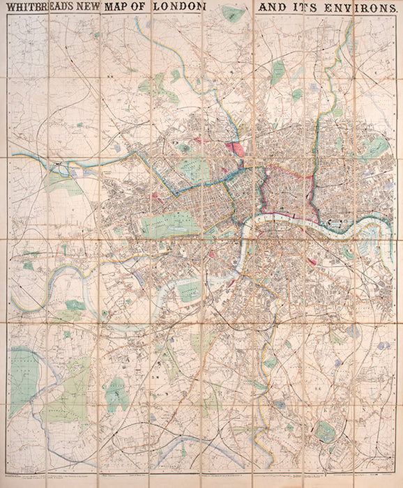
An engraved map of London and its environs published Josiah Whitbread, extending form Muswell Hill in the North to Mitcham in the South and from Turnham Green in the West to Deptford in the East.
With original hand-colouring showing the division of the metropolis into postal areas, and a companion index providing references to 20,000 streets, squares, postal district, cab fares, principal exhibitions and places of amusement.
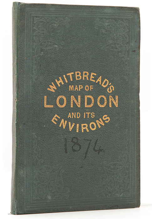
Engraved map of London (110 x 92 cm), dissected into 48 parts and laid onto linen as issued, original hand-colouring, folding with green endpaper into publisher's green cloth baords, lettered in gilt to upper cover dated '1874' in pen, ad, an old bookseller's label to front pastedown, bound with 42pp index including ads, last p. with tears at the gutter margin, clipped signature to index title, extremities of map slightly frayed, case slightly rubbed.
With original hand-colouring showing the division of the metropolis into postal areas, and a companion index providing references to 20,000 streets, squares, postal district, cab fares, principal exhibitions and places of amusement.
Engraved map of London (110 x 92 cm), dissected into 48 parts and laid onto linen as issued, original hand-colouring, folding with green endpaper into publisher's green cloth baords, lettered in gilt to upper cover dated '1874' in pen, ad, an old bookseller's label to front pastedown, bound with 42pp index including ads, last p. with tears at the gutter margin, clipped signature to index title, extremities of map slightly frayed, case slightly rubbed.
Provenance
Delivery
We offer secure and express delivery on all local and international orders of rare books, maps and prints placed through this website.