

GREENWOOD, Christopher & John.
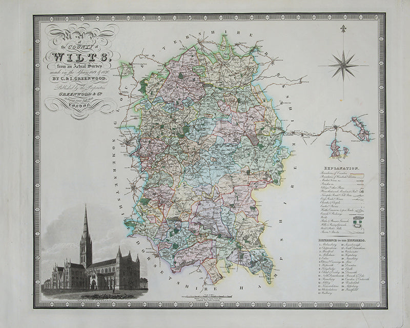
Map of the County of Wilts,
Map of the County of Wilts,
from an Actual Survey made in the Years 1819 & 1820.
Stock Code 122395
London, Greenwood & Co., Burleigh Street, Strand. 1829
C. and J. Greenwood, surveyors and publishers, began a survey of English and Welsh counties that started with Yorkshire in 1815, and continued through till 1834.
Engraved map issued without folds, with fine original full wash colour, an engraved vignette of Salisbury Cathedral, all within an engraved border. Sheet size: 647 mm x 810 mm. Some light soiling, creases to lower right, otherwise good.
Couldn't load pickup availability
Provenance
Provenance
Delivery
Delivery
We offer secure and express delivery on all local and international orders of rare books, maps and prints placed through this website.
About us
About us
Shapero Rare Books is an internationally renowned dealer in antiquarian & rare books and works on paper.
Our Bookshop and Gallery can be found in the heart of Mayfair at 94 New Bond Street, where most of our stock is available to view and on public display.
We exhibit at major international art fairs, including TEFAF (Maastricht and New York), Frieze Masters, Art Miami and Masterpiece London, as well as antiquarian & rare book fairs including New York, Paris, London, Los Angeles, San Francisco and Hong Kong.
Ask us a question
Ask us a question


FURTHER READING
View all-

Perils of the Sea
When we look at early voyages, we look at what they discovered, but perhaps their greatest achievement was that they completed the voyage at all, and that notable captains such...
Travel & ExplorationPerils of the Sea
Voyages and their CaptainsWhen we look at early voyages, we look at what they discovered, but perhaps their greatest achievement was that they completed the voyage at all, and that notable captains such...
-

Who Creates Our Image of a City?
Award-winning ancient historian Dr Jess Venner takes us through the ‘Views’ of the Folios of Francesco Panini and Jean Barbault.
Travel & ExplorationWho Creates Our Image of a City?
With Dr. Jess Venner, University of Oxford.Award-winning ancient historian Dr Jess Venner takes us through the ‘Views’ of the Folios of Francesco Panini and Jean Barbault.
-

'The Most Perfect Coloured Figure of a Bird'
Discover why Buller’s illustrated work on the unique Aotearoa birds of New Zealand is a rare instance where the second edition is more valuable than the first.
Science & Nature'The Most Perfect Coloured Figure of a Bird'
Buller's Birds of New ZealandDiscover why Buller’s illustrated work on the unique Aotearoa birds of New Zealand is a rare instance where the second edition is more valuable than the first.


