[BROWN, Glen Francis].
Arabian Peninsula
Arabian Peninsula
prepared by the U.S. Geological Survey and the Arabian American Oil Company under the joint sponsorship of the Kingdom of Saudi Arabia, Ministry of Finance and National Economy, and the U.S. Department of State.
Stock Code 112673
Washington D.C., The Survey [U.S. Geological Survey], 1958.
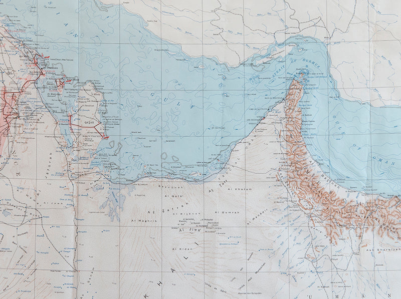
Large scale map of the Arabian Peninsula
The first edition, English language issue of this large-scale chromolithographed map of the Arabian Peninsula. Prepared by the U.S. Geological Survey for the Kingdom of Saudi Arabia and the Arabian-American Oil Company (Aramco), also capturing in detail the modern-day territories of Kuwait, Qatar, Bahrain, United Arab Emirates, Oman, and Yemen.The map is the result of a decade-long collaboration between the United States Geological Survey (USGS), who had been approached by King 'Abd al-'Aziz in 1944 for technical assistance in plotting the region's natural resources, the Saudi government, and Aramco.
Brown (1911-2001), who had expertise conducting groundwater surveys in Mississippi and Colorado, was selected to lead the project, arriving in 'Saudi Arabia early in 1945... His report on the results of [the] investigation [into water supplies in the Al-Kharj desert] was very enthusiastically received by Saudi officials... [and he returned at the King's requesrt] to conduct reconnaissance geologic mapping, mineral evaluation, and water-resource studies in the western and central parts of the kingdom. The mapping was carried forward from 1950 to 1958 by [Brown] with USGS and Saudi associates and extended to the entire Arabian Peninsula in cooperation with the Arabian American Oil Company' (Geological Society of America).
The result was a comprehensive series of geological and geographic surveys, the first of their type in the Arabian Peninsular, which were published in both Arabic and English language issues. These maps, together with reports on the geology, mineral deposits, and available water resources, continue to provide the basis for major national resource exploration and development in the region.
First edition; large chromolithographed map (121 x 138 cm); text in English; framed and glazed (overall size: 130 x 150 cm).
Couldn't load pickup availability
Provenance
Provenance
Delivery
Delivery
We offer secure and express delivery on all local and international orders of rare books, maps and prints placed through this website.
About us
About us
Shapero Rare Books is an internationally renowned dealer in antiquarian & rare books and works on paper.
Our Bookshop and Gallery can be found in the heart of Mayfair at 94 New Bond Street, where most of our stock is available to view and on public display.
We exhibit at major international art fairs, including TEFAF (Maastricht and New York), Frieze Masters, Art Miami and Masterpiece London, as well as antiquarian & rare book fairs including New York, Paris, London, Los Angeles, San Francisco and Hong Kong.
Ask us a question
Ask us a question


